lmccue1's map homepage | Butha-Buthe Map
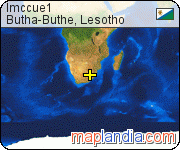
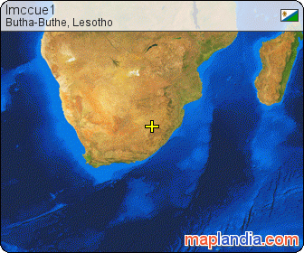
geographical location: Leribe, Lesotho, Africageographical coordinates: 28° 45' 46" South, 28° 15' 24" East
lmccue1's message to all visitors
This is Butha Buthe High School. The marker indicates the administration building. Teacher housing is to the north (above, on the map), and the classrooms are to the south. The forest, which is on the lower left portion of the map, is significant because each tree was planted by hand during the annual Lesotho National Tree Planting Day.
detailed map of lmccue1 home area in Butha-Buthe
![]() Welcome to the lmccue1's google satellite map! lmccue1 lives in Butha-Buthe area in Leribe, Lesotho. Original name (with diacritics) of the place is Butha-Buthe. See Butha-Buthe photos and images from satellite below, explore the aerial photographs of Butha-Buthe, explore the place where lmccue1 lives!
Welcome to the lmccue1's google satellite map! lmccue1 lives in Butha-Buthe area in Leribe, Lesotho. Original name (with diacritics) of the place is Butha-Buthe. See Butha-Buthe photos and images from satellite below, explore the aerial photographs of Butha-Buthe, explore the place where lmccue1 lives!
You can also dive right into lmccue1's home neighbourhood on unique 3D satellite map by Google Earth
Do you like this map? Link to it!
Register at Butha-Buthe or add new placemark for Butha-Buthe.
Get your personal map homepage and much more for free.
see lmccue1 in Butha-Buthe area map in Google Earth
![]() Want to know more about where does lmccue1 live? Dive right in — Google Earth combines detailed satellite imagery, maps and the power of Google Search to put the world's geographic information at your fingertips. Google Earth enables to tilt and rotate the view to see lmccue1's location3D terrain and buildings and much more (flying inclusive). Get Google Earth (free version) now and install it. When completed, simply click the link below. Explore the lmccue1 location! Explore the Lesotho area! Explore the world!
Want to know more about where does lmccue1 live? Dive right in — Google Earth combines detailed satellite imagery, maps and the power of Google Search to put the world's geographic information at your fingertips. Google Earth enables to tilt and rotate the view to see lmccue1's location3D terrain and buildings and much more (flying inclusive). Get Google Earth (free version) now and install it. When completed, simply click the link below. Explore the lmccue1 location! Explore the Lesotho area! Explore the world!
lmccue1's placemarks
| placemark | category | place |
|---|---|---|
| placemarks that lmccue1 has added | ||
| square | Butha-Buthe, Leribe, Lesotho | |
| street | Butha-Buthe, Leribe, Lesotho | |
| waterfall | Butha-Buthe, Leribe, Lesotho | |
lmccue1's map homepage link options
link to this page:
There are several options how to link to this map page — see the pretty images below. Please choose one and simply copy & paste mentioned HTML code into your page source code. Thank you for all links!
lmccue1's map homepage text link
lmccue1's map homepage micro bar image link
lmccue1's map homepage button image link
lmccue1's map homepage rectangle image link
lmccue1's map homepage large rectangle image link
large lmccue1's map homepage link
latest placemarks
- Dr. Mohammad Rimawi in New York, New York County, New York, United States
- Shawn Khodadadian in New York, New York County, New York, United States
- Airstrip in Orlyak, Dobric, Bulgaria
- Alternative Cleaning Ltd in Aldershot, Hampshire County, South East, England, United Kingdom
- Alternative Cleaning Limited in Aldershot, Hampshire County, South East, England, United Kingdom
random google map locations
- Waidsboro in Franklin County, Virginia, United States
- Gmeinschwenden in Unterallgau, Schwaben, Bayern, Germany
- Gongcun in Jingcheng, Shanxi, China
- Izh in Pizhanskiy rayon, Kirovskaya Oblast, Russia
Maplandia.com is not sponsored by or affiliated with Google.
- Copyright © 2005–2016 maplandia.com. All rights reserved.
- news
- faq
- contact us
- RSS
- XHTML & CSS